Spherical Panoramas allow the viewer to look in any direction, as if one were standing in the center of a sphere. The Spherical Panorama does away with the photographer's single framed point of view. You are free to explore every angle and to inspect any detail of the image by zooming in and around the total sphere.
You can also view these images within Google Earth or at 360Cities see the links at the bottom of this page.
You will require a viewer to see the images, if you don't have one installed already (there are several available free) then the system will offer you a link. If you prefer to manually control the viewer selection then please make your choice below.
Select viewer:
If you would like to know more about the methods used to create these images then the following sites will guide you PanoTools
Wiki and the PanoTools mailing list.
The equipment used for photography is described here.
To view the panoramas click the thumbnail images below.
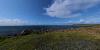
A night's wild camping close to the shoreline looking out across to Galloway.
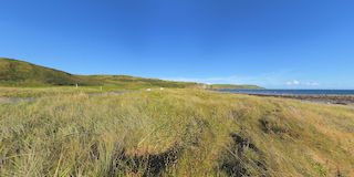
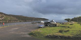
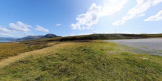
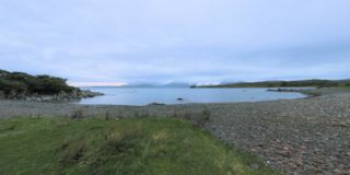
Luce Bay and Mull of Galloway
A nights wild camping near Monreith on the shores of Luce Bay looking out to Galloway.
Kirckcolm Lighthouse
Looking out into Irish Sea and the ferries coming into Strannaer.
Pulpit Hill above Oban
Just to the South of the town, is Pulpit Hill, well worth a visit, even if the drive is a little circular!
Port Logan
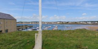
Another small scottish harbour facing on to the Mull of Galloway
Struie Hill
A rather nice viewing point, coming down the East side of Scotland.
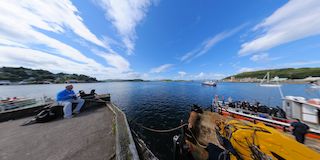
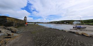
Uig Harbour
The Harbour arm at Uig, and a nice bottle of Skye Whisky from the distillery ;-)
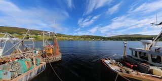
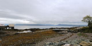
Toscaig Harbour
A nights Wild-camping saw the weather change at about 03:00, we felt rather wind swept on the quay side come dawn!
Drumore Lighthouse Helipad
From the old Helipad the cottages that are now the RSPB Mull of Galloway site can be seen.
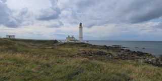
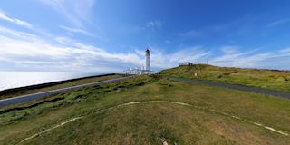
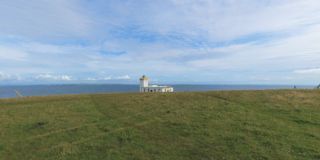
Drumore Lighthouse
The most southely point in Scotland, with, to the left of the lighthouse the Isle of Man visible on the horizon and Cumbria to the East, and with Ireland visible to the right.
Bonar Bridge Rocks
Beside the bridge itself is this little area that describes they types of rocks, along with examples outside the path, to be found around Scotland.
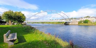
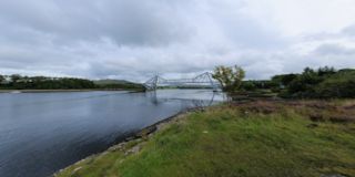
Bonar Bridge over the river Oykel
From the banks of the Oykel in Bonar as it exits into the Dornoch Firth.
Shilasdair Garden
The Syke Yarn Companies shop garden which contains several of the plants used for dyeing the wool.
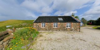
Shilasdair
The Skye Yarn Company shop on the Waternish Peninsula.
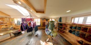
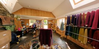
Shilasdair
The Skye Yarn Company shop on the Waternish Peninsula.
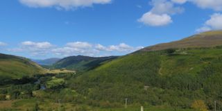
River Garve
Having eaten our lunch on the rocks the view just had to be captured as well.
Strathgarve Bridges
Looking down from the old bridge onto the river Garve, behind us the new bridge can be seen.
Inside McCaig's Tower
A view from inside the tower and its gardens.
McCaig's Tower
Overlooking Oban from the tower.
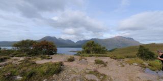
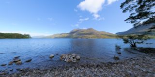
Loch Torridon - Beinn Alligin
From nearer the Eastern end of the Loch views across to Benn Alligin and Liathach.
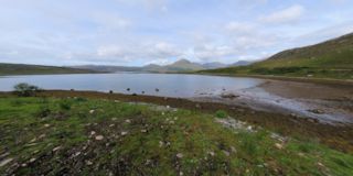
Loch Torridon
Loch Torridon is a Sea Loch and has several parts this is a view of parts of the Upper Loch.
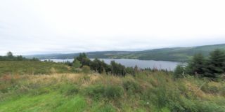
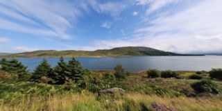
Loch Maree
There are some great walks to be taken either beside this Loch or in the Beinn Eighe National Nature Reserve beside the Loch.
Loch Lommond
Perhaps one of the busiest Lochs in Scotland !
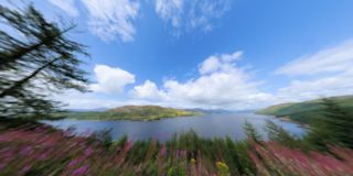
Loch Creran & the Connel Bridge
A nice little spot just North of Oban.
Loch Awe
This is the longest Loch in Scotland at 41Km (25.5 miles).
Kylesku Bridge
The approach to this bridge from the South is sudden and then as you pass over the bridge and get to the Northern side its visible for miles!
Inchnadamph Ardvrech Castle
Beside Loch Assynt these ruins stand on a small island.
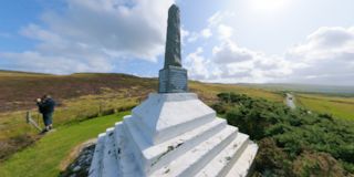
Gairloch War Memorial
This new location for the War Memorial looks out over Loch Gairloch, with the village to the North and the beaches to the South.
Gairloch
Taken from the North side and above the village in the morning Sun.
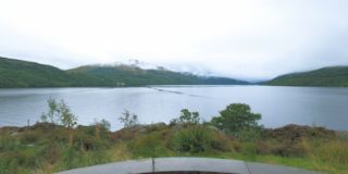
Loch Nan Uamh
This sea loch is on the A830 from Fort William to Mallaig.
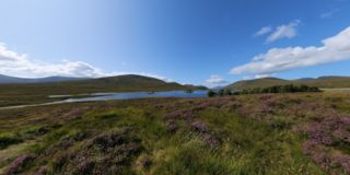
Loch Croisg
We came across this peaceful Loch near the village of Badavanich whilst touring around the Wester Ross area.
Duncansby Head
The furthest point from Lands End on the Mainland UK. The nearest habitation and of course the main tourist point is John O'Groats a few miles to the East!
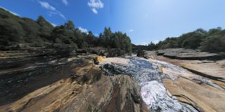
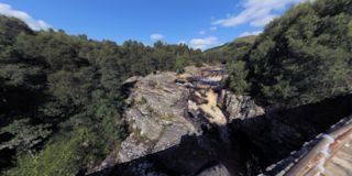
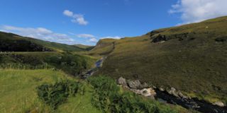
Corrieshalloch Gorge
Part of the Wester Ross Coastal Trail this gorge runs down into the sea past Ullapool
Badluchrach
Following along the Wester Ross Trail, this view from above the village of Badlurchrach looks out over to Scoraig in the distance.
Loch Carron
This location on the A890 near Ardnarff overlooks this sea loch for all of its Eastern end.
Wester Ross Coastal Trail
Following the A832 road brings you to this delightful spot where the river that parallels this road has just been crossed and its tumbling fall down to the sea can be watched.
Tokavaig Bay
An evening view across the quiet Bay the Sun has almost set and is hidden behind the Cuillin hills.
Glencoe
Glencoe from the C&CC campsite
Uig
From high on the hills above Uig the ferry port is visible as well.
Uig
Uig from across the bay.
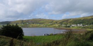
Kyleakin - Skye Bridge
Loch Alsh from Kyleakin with the Skye bridge to the West.
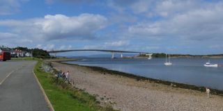
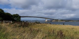
Skye Bridge
The Skye bridge from the edge of the Kyle of lochalsh
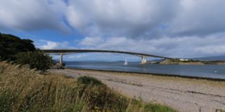
Skye Bridge
The Skye bridge from the road.
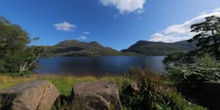
Loch Maree
Another view of the Loch from one of the short walks along the shore line.
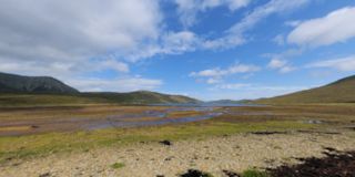
Loch Droma
Whilst navigating around Wester Ross area we took a break overlooking this Loch for a few minutes.
War memorial at Hallin
This War memorial looks out from the Waternish Peninsula across the Loch of Dunvegan to Dunvegan Head.
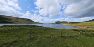
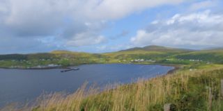
Loch Ainort
At the end of the Loch is the island of Scalpay to the South and Raasay to the North.
Duntulm
Next stop is Stornoway Hebrides due North
Scalpay from Dunan
The island of Scalpay across Lochalsh from the East coast road.
Armadale ferry port
The approachs to the port across Lochalsh to Mallaig
Armadale Ferry Port, Skye
More visitors to Skye arrive up the ramp.
St. Andrews Harbour Arm
The Arm looks back across the harbour and up the hill to the catherdral, whilst out at sea the Tall ship Stad Amsterdam can be seen at anchor.
St. Andrews Harbour
The inner and outer harbours.
St Andrews Cathedral
The ruins of the cathedral in St. Andrews and beside it St. Rules Church
Elie Harbour Arm
Elie inner harbour from the Arm.
Elie Harbour
Elie in Fife is situated on the East coast of Scotland and lies on the mouth Firth of Forth.

 Sitting on the dock of the bay ....
 A night's wild camping close to the shoreline looking out across to Galloway.
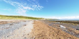 A nights wild camping near Monreith on the shores of Luce Bay looking out to Galloway.
 Looking out into Irish Sea and the ferries coming into Strannaer.
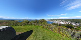 Just to the South of the town, is Pulpit Hill, well worth a visit, even if the drive is a little circular!
 Another small scottish harbour facing on to the Mull of Galloway
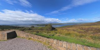 A rather nice viewing point, coming down the East side of Scotland.
 The Harbour arm at Uig, and a nice bottle of Skye Whisky from the distillery ;-)
 A nights Wild-camping saw the weather change at about 03:00, we felt rather wind swept on the quay side come dawn!
 From the old Helipad the cottages that are now the RSPB Mull of Galloway site can be seen.
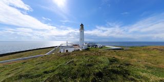 The most southely point in Scotland, with, to the left of the lighthouse the Isle of Man visible on the horizon and Cumbria to the East, and with Ireland visible to the right.
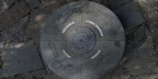 Beside the bridge itself is this little area that describes they types of rocks, along with examples outside the path, to be found around Scotland.
 From the banks of the Oykel in Bonar as it exits into the Dornoch Firth.
 The Syke Yarn Companies shop garden which contains several of the plants used for dyeing the wool.
 The Skye Yarn Company shop on the Waternish Peninsula.
 The Skye Yarn Company shop on the Waternish Peninsula.
 Having eaten our lunch on the rocks the view just had to be captured as well.
 Looking down from the old bridge onto the river Garve, behind us the new bridge can be seen.
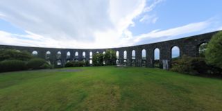 A view from inside the tower and its gardens.
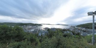 Overlooking Oban from the tower.
 From nearer the Eastern end of the Loch views across to Benn Alligin and Liathach.
 Loch Torridon is a Sea Loch and has several parts this is a view of parts of the Upper Loch.
 There are some great walks to be taken either beside this Loch or in the Beinn Eighe National Nature Reserve beside the Loch.
 Perhaps one of the busiest Lochs in Scotland !
 A nice little spot just North of Oban.
 This is the longest Loch in Scotland at 41Km (25.5 miles).
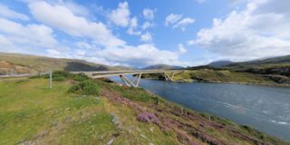 The approach to this bridge from the South is sudden and then as you pass over the bridge and get to the Northern side its visible for miles!
 Beside Loch Assynt these ruins stand on a small island.
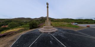 This new location for the War Memorial looks out over Loch Gairloch, with the village to the North and the beaches to the South.
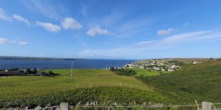 Taken from the North side and above the village in the morning Sun.
 This sea loch is on the A830 from Fort William to Mallaig.
 We came across this peaceful Loch near the village of Badavanich whilst touring around the Wester Ross area.
 The furthest point from Lands End on the Mainland UK. The nearest habitation and of course the main tourist point is John O'Groats a few miles to the East!
 Part of the Wester Ross Coastal Trail this gorge runs down into the sea past Ullapool
 Following along the Wester Ross Trail, this view from above the village of Badlurchrach looks out over to Scoraig in the distance.
 This location on the A890 near Ardnarff overlooks this sea loch for all of its Eastern end.
 Following the A832 road brings you to this delightful spot where the river that parallels this road has just been crossed and its tumbling fall down to the sea can be watched.
 An evening view across the quiet Bay the Sun has almost set and is hidden behind the Cuillin hills.
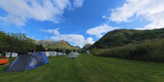 Glencoe from the C&CC campsite
 From high on the hills above Uig the ferry port is visible as well.
 Uig from across the bay.
 Loch Alsh from Kyleakin with the Skye bridge to the West.
 The Skye bridge from the edge of the Kyle of lochalsh
 The Skye bridge from the road.
 Another view of the Loch from one of the short walks along the shore line.
 Whilst navigating around Wester Ross area we took a break overlooking this Loch for a few minutes.
 This War memorial looks out from the Waternish Peninsula across the Loch of Dunvegan to Dunvegan Head.
 At the end of the Loch is the island of Scalpay to the South and Raasay to the North.
 Next stop is Stornoway Hebrides due North
 The island of Scalpay across Lochalsh from the East coast road.
 The approachs to the port across Lochalsh to Mallaig
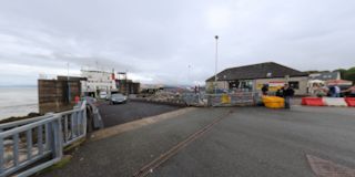 More visitors to Skye arrive up the ramp.
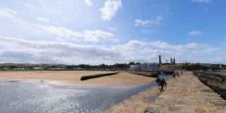 The Arm looks back across the harbour and up the hill to the catherdral, whilst out at sea the Tall ship Stad Amsterdam can be seen at anchor.
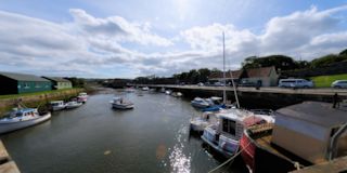 The inner and outer harbours.
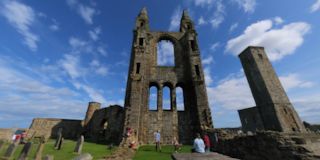 The ruins of the cathedral in St. Andrews and beside it St. Rules Church
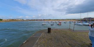 Elie inner harbour from the Arm.
 Elie in Fife is situated on the East coast of Scotland and lies on the mouth Firth of Forth.


